Back Shibuya, Tokyo ACE شيبويا (طوكيو) Arabic شيبويا, طوكيو ARZ Şibuya Azerbaijani Shibuya BAN Сібуя (адмысловы раён) Byelorussian Shibuya Catalan Сибуя (махсус район) CE Shibuya-ku CEB شیبویا CKB
Shibuya
渋谷区 | |
|---|---|
| Shibuya City | |
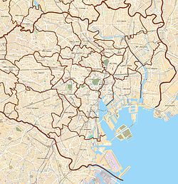
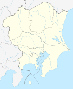
 Location of Shibuya in Tokyo | |
| Coordinates: 35°39′34″N 139°42′02″E / 35.65944°N 139.70056°E | |
| Country | Japan |
| Region | Kantō |
| Prefecture | Tokyo |
| Government | |
| • Mayor | Ken Hasebe (since April 2015) |
| Area | |
• Total | 15.11 km2 (5.83 sq mi) |
| Population (October 1, 2020[1]) | |
• Total | 243,883 |
• Estimate (2024) | 230,609 |
| • Density | 16,140/km2 (41,800/sq mi) |
| Time zone | UTC+9 (Japan Standard Time) |
| Symbols | |
| • Tree | Zelkova serrata |
| • Flower | Iris ensata |
| City office | Shibuya 1-18-21, Shibuya-ku, Tokyo 150-8010 |
| Website | www |
Shibuya (渋谷区, Shibuya-ku, IPA: [ɕibɯja] ⓘ) is a special ward in Tokyo, Japan. A major commercial center, Shibuya houses one of the busiest railway stations in the world, Shibuya Station.
As of January 1, 2024, Shibuya Ward has an estimated population of 230,609 in 142,443 households[2] and a population density of 15,262.01 people per square kilometre (39,528.4 people/sq mi). The total area is 15.11 km2 (5.83 sq mi). Notable neighborhoods and districts of Shibuya include Harajuku, Ebisu, Omotesandō, Yoyogi and Sendagaya.
Shibuya came into the possession of the Shibuya clan in the early 1160s, after which the area was named. The branch of the clan that ruled this area was defeated by the Later Hōjō clan on January 13, 1524, during the Sengoku period, and the area then came under their control.[3] During the Edo period, Shibuya, particularly Maruyamachō on Dōgenzaka, prospered as a town on Oyama Road (present-day Route 246), and in the Meiji era, as a Hanamachi. Shibuya emerged as a railway terminus during the expansion of the railway network beginning in the 19th century, and was incorporated as a ward in the City of Tokyo on October 1, 1932.[4]
Shibuya, once a mediocre area developed around the railway terminus, overtook Shinjuku as a hub for youth culture in the 1970s. The coinciding competition between Seibu (whose most notable development projects include Shibuya Parco) and Tokyu (Tokyu Hands,Shibuya 109) to develop the area as a commercial center added to its appeal to young people, which in turn spread to other neighborhoods in the ward, such as Harajuku.[5][6]
The Shibuya Scramble Crossing, known as the busiest pedestrian crossing in the world, the panoramic view of the city from the rooftop of Shibuya Scramble Square, and the statue of Hachikō are internationally recognized tourist attractions.[7]
Since the beginning of the 21st century, large-scale redevelopment has been underway in the area surrounding Shibuya Station. The scale of the project has been described as something that happens once in a hundred years.[8] In 2005, the Japanese government designated the district as an Urban Renewal Area. Following discussions among scholars, the Ministry of Land, Infrastructure, Transport and Tourism, the Tokyo Metropolitan Government, Shibuya City Office, and railway operators such as Tokyu Corporation, JR East, and Tokyo Metro, a master plan was announced in 2008.[9] In 2010, the Tokyo Metropolitan Government approved the implementation of the redevelopment plan, and full-scale construction officially began.[10] As part of the redevelopment, the existing station facilities were demolished. The Tōyoko Line was moved underground, the Ginza Line platform was relocated, and the Saikyō Line platform was placed parallel to the Yamanote Line platform. Several existing commercial buildings were also demolished and replaced by high-rise complexes such as Shibuya Hikarie, Shibuya Stream, Shibuya Fukuras (ja), Shibuya Sakura Stage (ja), and Shibuya Scramble Square.[11] Because railway operations had to continue during construction, and because the pedestrian network plan around the station was revised during the process, the overall completion of the redevelopment is now scheduled for fiscal year 2034, which is seven years later than originally planned.[8][12]
- ^ "Population by District". Tokyo Statistical Yearbook. Retrieved July 15, 2022.
- ^ "町丁目別世帯数及び人口 | 渋谷区ポータル". Shibuya City Official Website (in Japanese). Retrieved May 7, 2024.
- ^ "ご祈願・ご参拝|【金王八幡宮】|東京都渋谷区東京都渋谷区|金王八幡宮について". www.konno-hachimangu.jp. Retrieved November 13, 2024.
- ^ "渋谷区の歴史 | 区の紹介 | 渋谷区ポータル". www.city.shibuya.tokyo.jp (in Japanese). Retrieved November 13, 2024.
- ^ "「東急vs西武」懐かしき渋谷の"熱狂時代"を辿る". 東洋経済オンライン (in Japanese). January 5, 2023. Retrieved November 13, 2024.
- ^ "渋谷の東急・西武はいかにして「消費文化の象徴」となったのか――東急本店解体で考える". アーバンライフ東京 (in Japanese). February 10, 2019. Retrieved November 13, 2024.
- ^ "Tokyo's Shibuya Crossing: Welcome to the world's wildest intersection". CNN. November 14, 2019. Archived from the original on July 9, 2022. Retrieved May 16, 2025.
- ^ a b ~「100 年に一度」の大規模再開発、渋谷駅街区計画、最終章へ~ 2030 年度に渋谷駅および駅を中心とした歩行者ネットワークが概成を迎え 翌年度、渋谷スクランブルスクエア第Ⅱ期(中央棟・西棟)が完成します (PDF) (in Japanese). Tokyu Corporation, JR East and Tokyo Metro. May 9, 2025. Archived from the original (PDF) on May 9, 2025. Retrieved May 16, 2025.
- ^ 「渋谷駅街区基盤整備方針」の公表について (in Japanese). Tokyo Metropolitan Government. June 30, 2008. Archived from the original on July 16, 2008. Retrieved May 16, 2025.
- ^ 渋谷駅街区土地区画整理事業の施行認可について (in Japanese). Tokyo Metropolitan Government. October 13, 2010. Archived from the original on March 21, 2012. Retrieved May 16, 2025.
- ^ 各再開発プロジェクトの概要 (in Japanese). Shibuya City. Archived from the original on February 11, 2025. Retrieved May 16, 2025.
- ^ 各再開発プロジェクトの概要 (in Japanese). TV Tokyo. May 9, 2025. Archived from the original on May 13, 2025. Retrieved May 16, 2025.
© MMXXIII Rich X Search. We shall prevail. All rights reserved. Rich X Search


