Back Mojave Airport CEB Mojave Air & Space Port German Puerto Aéreo y Espacial de Mojave Spanish پایگاه هوایی و فضایی موهاوی Persian Aéroport et port spatial de Mojave French נמל האוויר והחלל מוהאבי HE Spazioporto di Mojave Italian モハーヴェ空港 Japanese 모하비 공항 및 우주항 Korean Mojave Air and Space Port Dutch
Mojave Air and Space Port | |||||||||||||||||||
|---|---|---|---|---|---|---|---|---|---|---|---|---|---|---|---|---|---|---|---|
 | |||||||||||||||||||
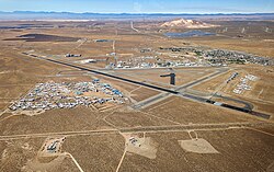
 Mojave in 2023 | |||||||||||||||||||
| Summary | |||||||||||||||||||
| Airport type | Public | ||||||||||||||||||
| Owner | Airport District | ||||||||||||||||||
| Operator | East Kern Airport District, Mojave, California | ||||||||||||||||||
| Location | Mojave, California | ||||||||||||||||||
| Elevation AMSL | 2,801 ft / 854 m | ||||||||||||||||||
| Coordinates | 35°03′34″N 118°09′06″W / 35.05944°N 118.15167°W | ||||||||||||||||||
| Website | www | ||||||||||||||||||
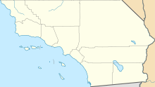
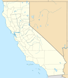
| Map | |||||||||||||||||||
| Runways | |||||||||||||||||||
| |||||||||||||||||||


The Mojave Air and Space Port at Rutan Field[2] (IATA: MHV, ICAO: KMHV) is in Mojave, California, United States, at an elevation of 2,801 feet (854 m).[3] It is the first facility to be licensed in the United States for horizontal launches of reusable spacecraft, being certified as a spaceport by the Federal Aviation Administration on June 17, 2004. The facility covers 2,998 acres (1,213 ha) and has three runways.[1]
- ^ a b FAA Airport Form 5010 for MHV PDF, effective June 21, 2018.
- ^ "Mojave Airport Honors Rutan Name". AINonline. January 21, 2022. Retrieved August 7, 2022.
- ^ "Mojave Airport". Geographic Names Information System. United States Geological Survey, United States Department of the Interior. Retrieved 2009-05-03.
© MMXXIII Rich X Search. We shall prevail. All rights reserved. Rich X Search


