Back Východní Texas Czech Osttexas German Texas de l'Est French Texas orientale Italian Texia Orientalis Latin Texas Oriental Portuguese Восточный Техас Russian East Texas SIMPLE
31°52′N 94°55′W / 31.867°N 94.917°W
East Texas | |
|---|---|
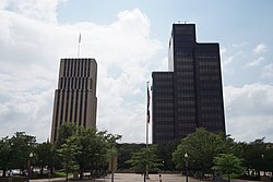
From top to bottom, left to right: Downtown Kilgore, Downtown Tyler; Paris; Kayaking in Caddo Lake; Dirt biking in the Piney woods; Commercial Historic District and Downtown Beaumont | |
| Nickname: | |
 East Texas counties in red; the inclusion of pink and red counties varies from source to source, thus may or may not be included in East Texas | |
| Country | |
| State | |
| Counties | Anderson Angelina Bowie Camp Cass Cherokee Delta Franklin Gregg Hardin Harrison Henderson Hopkins Houston Hunt Jasper Jefferson Lamar Marion Morris Nacogdoches Newton Orange Panola Polk Rains Red River Rusk Sabine San Augustine San Jacinto Shelby Smith Titus Trinity Tyler Upshur Van Zandt Wood[1] |
| Largest city | Tyler[3] |
| Population (2020) | |
• Total | 1,918,628[1] |
East Texas is a broadly defined cultural, geographic, and ecological region in the eastern part of the U.S. state of Texas that consists of approximately 38 counties. It is roughly divided into Northeast, Southeast, and Deep East Texas. Most of the region consists of the Piney Woods ecoregion. East Texas can sometimes be defined only as the Piney Woods.[1] At the fringes, towards Central Texas, the forests expand outward toward sparser trees and eventually into open plains.
According to the Handbook of Texas, the East Texas area "may be separated from the rest of Texas roughly by a line extending from the Red River in north-central Lamar County southwestward to east-central Limestone County and then southeastward towards eastern Galveston Bay". Most sources separate the Gulf Coast area into a separate region.[4]
The East Texas region includes Kilgore, Tyler, Longview, Texarkana, Lufkin, Marshall, Palestine, Henderson, Jacksonville, Mount Pleasant, and Nacogdoches as principal cities in addition to, in its expanded definition, Greenville, Houston, and Beaumont metropolitan statistical areas.
- ^ a b c "The Regions of Texas". Texas Counties. net. Retrieved 16 October 2014.
- ^ "Running to state: Kilgore Bulldogs are the fastest 4x2 relay team in ETX". KLTV. May 11, 2017. Retrieved 5 February 2025.
- ^ a b "East Texas – ETX Life".
- ^ E.H. Johnson. "East Texas". Handbook of Texas Online. Texas State Historical Association. Retrieved April 12, 2017.
© MMXXIII Rich X Search. We shall prevail. All rights reserved. Rich X Search


