Back دير الزور Arabic دير الزور ARZ Deyr əz-Zor Azerbaijani دیرالزور AZB Дэйр-эз-Зор Byelorussian Дейр ез-Зор Bulgarian Deir al-Zor Catalan Deir ez-Zor (kapital sa lalawigan sa Sirya) CEB دێرەزوور CKB Dajr az-Zaur Czech
Deir ez-Zor
دير الزور | |
|---|---|
 Suspension bridge of Deir ez-Zor • Memorial of Armenian genocide Euphrates River • March 8 Square Panorama of Deir ez-Zor | |
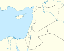
| Coordinates: 35°20′N 40°9′E / 35.333°N 40.150°E | |
| Country | |
| Governorate | Deir ez-Zor Governorate |
| District | Deir ez-Zor District |
| Subdistrict | Deir ez-Zor Subdistrict |
| Control | Syrian transitional government |
| Date of establishment | 3000 BC (old Deir Ezzour) |
| Government | |
| • Governor | Munhal Nader Hanawi[2] |
| • Mayor | Mohamed Ibrahim Samra |
| Elevation | 210 m (690 ft) |
| Population (2018 census) | |
• Total | 271,800[1] |
| Demonym(s) | Deiri Arabic: ديري, romanized: Dayri |
| Time zone | UTC+3 (AST) |
| Area code(s) | Country code: 963 City code: 051 |
| Geocode | C5086 |
| Climate | BWh |
| International airport | Deir ez-Zor Airport |
 | |
Deir ez-Zor (Arabic: دَيْرُ ٱلزَّوْرِ / دَيْرُ ٱلزُّور, romanized: Dayru z-Zawr / Dayru z-Zūr) is the largest city in eastern Syria and the seventh largest in the country. Located on the banks of the Euphrates 450 km (280 mi) to the northeast of the capital Damascus, Deir ez-Zor is the capital of the Deir ez-Zor Governorate.[3] In the 2018 census, it had a population of 271,800.
- ^ "Deir ez-Zor city population". Archived from the original on 31 July 2012.
- ^ "الرئيس الأسد يصدر مَراسيم بتعيين محافظين جدد لخمس محافظات" [President Al-Assad issues decrees appointing new governors for five governorates]. S a N A. SANA. 17 October 2024. Retrieved 17 October 2024.
- ^ "Syrian Ministry of Tourism (in Arabic)". Archived from the original on 27 April 2020. Retrieved 10 May 2007.
© MMXXIII Rich X Search. We shall prevail. All rights reserved. Rich X Search


