Back بينبريج آيلاند Arabic بينبريج آيلاند ARZ Бейнбридж Айланд Bulgarian Bainbridge Island Catalan Острив Бейнбридж CE Bainbridge Island (lungsod) CEB Bainbridge Island, Washington Welsh Bainbridge Island German Bainbridge Island (Vaŝingtonio) Esperanto Bainbridge Island Spanish
Bainbridge Island, Washington | |
|---|---|
| City of Bainbridge Island | |
 Aerial view of Bainbridge Island | |
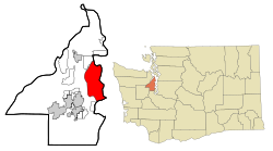
 Location of Bainbridge Island, Washington | |
| Coordinates: 47°38′19″N 122°30′26″W / 47.63861°N 122.50722°W | |
| Country | United States |
| State | Washington |
| County | Kitsap |
| Named after | William Bainbridge |
| Government | |
| • Type | Council–manager |
| • Body | City council[1] |
| • Mayor | Joe Deets |
| • City Manager | Blair King[2] |
| Area | |
• Total | 65.08 sq mi (168.55 km2) |
| • Land | 27.61 sq mi (71.52 km2) |
| • Water | 37.46 sq mi (97.03 km2) |
| Elevation | 102 ft (31 m) |
| Population (2020) | |
• Total | 24,825 |
| • Density | 916.1/sq mi (353.72/km2) |
| Time zone | UTC-8 (Pacific (PST)) |
| • Summer (DST) | UTC-7 (PDT) |
| ZIP Code | 98110 |
| Area code | 206 |
| FIPS code | 53-03736 |
| GNIS feature ID | 2409770[4] |
| Website | bainbridgewa |
Bainbridge Island is a city and island in Kitsap County, Washington, United States. It is located in Puget Sound. The population was 24,825 at the 2020 census,[5] making Bainbridge Island the second largest city in Kitsap County.
The island is separated from the Kitsap Peninsula by Port Orchard, with Bremerton lying to the southwest. Bainbridge Island is a suburb of Seattle, connected via the Washington State Ferries system and to Poulsbo and the Suquamish Indian Reservation by State Route 305, which uses the Agate Pass Bridge.
- ^ "Government | Bainbridge Island, WA – Official Website". www.bainbridgewa.gov. Retrieved January 25, 2020.
- ^ "Executive | Bainbridge Island, WA – Official Website". City of Bainbridge Island. Retrieved June 12, 2020.
- ^ "2019 U.S. Gazetteer Files". United States Census Bureau. Retrieved August 7, 2020.
- ^ a b U.S. Geological Survey Geographic Names Information System: Bainbridge Island, Washington
- ^ "2020 Census Data". United States Census Bureau. Retrieved October 9, 2023.
© MMXXIII Rich X Search. We shall prevail. All rights reserved. Rich X Search


