Back آشبورن (فرجينيا) Arabic اشبورن (منطقه فى امريكا) ARZ آشبورن، ویرجینیا AZB Ашбърн Bulgarian Ешберн (Виргини) CE Ashburn (lungsod) CEB Ashburn (Virginie) Czech Ashburn, Virginia Welsh Ashburn (Virginia) German Ashburn (Virginia) Spanish
Ashburn, Virginia | |
|---|---|
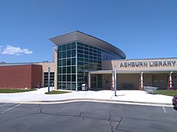
 Ashburn Library | |
| Coordinates: 39°02′37″N 77°29′15″W / 39.04361°N 77.48750°W[1] | |
| Country | United States |
| State | Virginia |
| County | Loudoun |
| Area | |
• Total | 15.55 sq mi (40.3 km2) |
| • Land | 15.30 sq mi (39.6 km2) |
| • Water | 0.25 sq mi (0.6 km2) |
| Elevation | 253 ft (77 m) |
| Population | |
• Total | 46,349 |
| • Density | 3,030.3/sq mi (1,170.0/km2) |
| Time zone | UTC−5 (Eastern (EST)) |
| • Summer (DST) | UTC−4 (EDT) |
| ZIP codes | 20146, 20147, 20148, 20149[4] |
| Area codes | 703, 571 |
| FIPS code | [2] |
| ANSI code | 2584799[2] |
| GNIS feature ID | 1499063[1] CDP: 2584799[5] |
Ashburn is a unincorporated settlement and census-designated place (CDP) in Loudoun County, Virginia, United States. At the 2020 United States census, its population was 46,349,[3] up from 3,393 in 1990. It is 30 miles (48 km) northwest of Washington, D.C., and part of the Washington metropolitan area. Ashburn is a major hub for Internet traffic due to its many data centers.[6]
- ^ a b c "Ashburn". Geographic Names Information System. United States Geological Survey, United States Department of the Interior.
- ^ a b c "2020 U.S. Gazetteer Files –Virginia". United States Census Bureau. Retrieved February 19, 2021.
- ^ a b "Ashburn CDP, Virginia; DP1: Profile of General Population and Housing Characteristics - 2020 Census of Population and Housing". data.census.gov. U.S. Census Bureau. Retrieved May 29, 2025.
- ^ "Post Office, Zip Code, Jurisdiction and AAA Cross-Reference List" (PDF). Virginia Department for the Aging. June 9, 2004.
- ^ "Ashburn Census Designated Place". Geographic Names Information System. United States Geological Survey, United States Department of the Interior.
- ^ Blum, Andrew (May 29, 2012). "The Bullseye of America's Internet". Gizmodo.
© MMXXIII Rich X Search. We shall prevail. All rights reserved. Rich X Search


